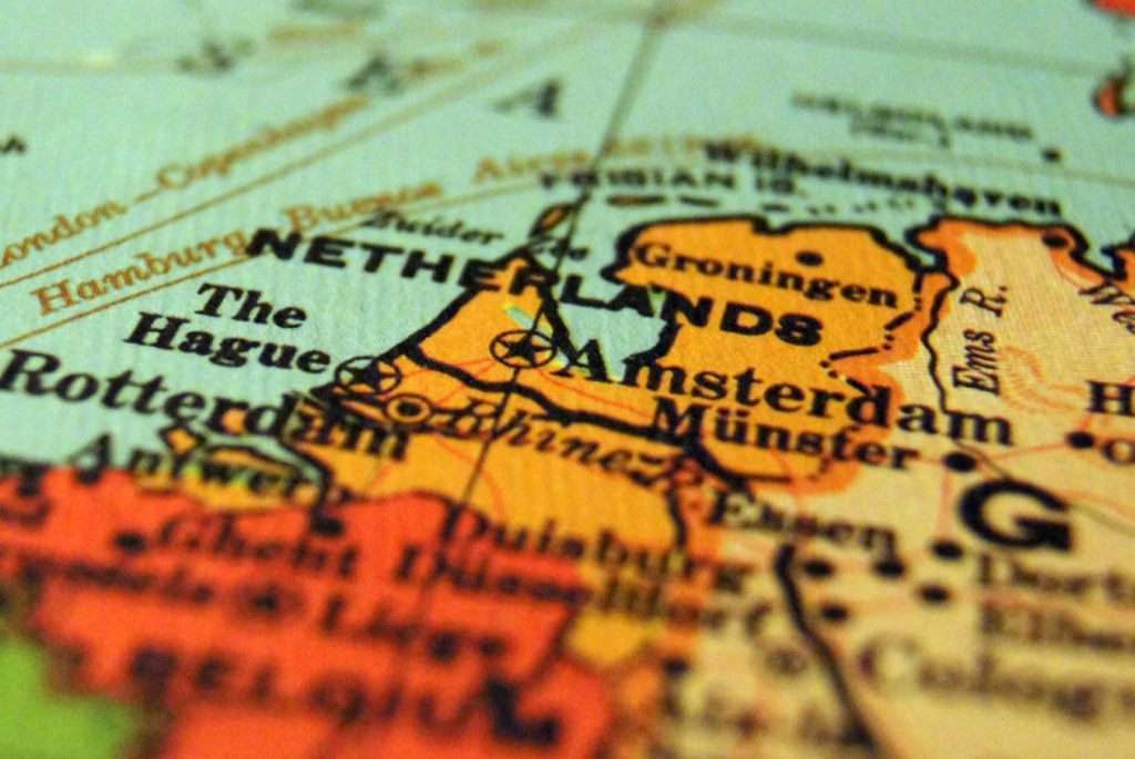
Where is Amsterdam (Holland / Netherlands) located?
Amsterdam is a city that is also the capital of Netherlands. Netherlands is a small country that is located in the North West part of Europe. This country borders Belgium to the south, Germany to the east and North Sea to the west and north. If you are looking Amsterdam on the map, you will find it on coordinates 4053’on the east longitude and 52022’ on the North latitude. Essentially, it is about 52 degrees north of Equator and 4 degrees east of London, which stands at 0 degrees.
Most people across the world know the Netherlands as Holland. However, Holland represents two provinces on the western part of Netherlands, which are South and North Holland. The city is generally a metropolitan urban setting. However, the majority of the residents of the country are the Dutch.
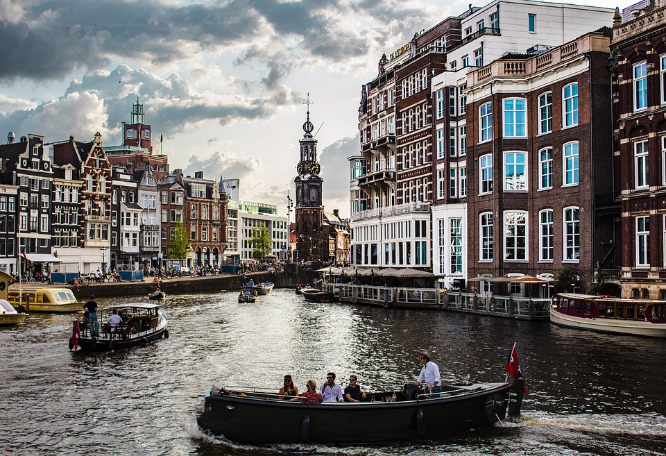
The city of Amsterdam is located near the edge of North Holland province. However, it is not the capital of the province. The provincial capital is called Haarlem. Despite being the capital of Netherlands, Amsterdam is not the seat of the government as the Dutch government is located at The Hague. However, Amsterdam is the cultural capital of the country as it hosts a thriving live performance and art scene, leading orchestra bands, some of the largest museums and two universities. It also has a rich history behind it. Over four million visitors tour the city every year to see some of its historic architecture and enjoy the feeling of cultural liberty.
The Globalisation and World Cities study group classifies Amsterdam as an alpha city. Amsterdam has also been voted as the second best city to live in the world by the Economic Intelligence Unit and 12th based on maintenance of the environment and the quality of various pieces of infrastructure. Besides, its port is one of the largest across Europe.